Sunday, October 4, 2020

I HAVE POSTED MORE VITAL EARTHQUAKES AT:NICOLE&HER LUCIFEREAN CREW OF OBSESSED PSYCHOPATHS!!!1556 Shaanxi earthquake *NICOLE BRIN SAT WATCHING IN AGREEMENT SERGEY:LUCIAN REMOVING MY!!! REVELATION 12 LOTR ETC.PICTURES!!!SUNDAR HELPS TO DO THIS AS WELL.

MY REVELATION 12 LOTR ETC.CASTLE IN MY HOMETOWN IS STILL HAPPENING.SEALED. SAKIEMLAYECHID.SAKIYECHID.SKIEMLAYECHID.SAKIEMLAYECHID.

See the source image
Image result for Bilbo Baggins Crazed Over the Ring

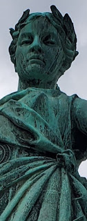
"I AM THEE WOMAN."THIS MIRACULOUS HEBREW EVERLASTING MARRIAGE BLOOD COVENANT IS OF WHO IAM STANDING ON THE REVELATION 12 LOTR ETC.CLIFF'S EDGE:MOON."LOTR ETC.
See the source image

🛫


See the source imageSee the source imageSee the source image


*AND:I AM:"L'IRIS"

A SEXUALLY-BROKEN HYMEN IS NOT ALLOWED.


 la Rose.(fleurira la Rose)(quand fleurira la Rose)
A SEXUALLY-BROKEN HYMEN IS NOT ALLOWED.

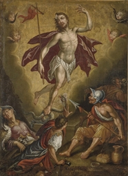
*I AM THE ROSE SPOKEN OF IN THE REVELATION 12 LOTR ETC.PROPHECIES&GOD MADE A MIRACULOUS PICTURE OF MY SELF IN THIS ROSE.
*I AM REPRESNTED BY:THE ROSE.
*I AM LIKENED UNTO:MARY MAGDELENE.


Earthquakes Ciburial..."*NO.TO ANY:CHRIST IRIS BURIAL IRIS NOAH DOOR NOAH 
EVE II SION:SAVIOUR IRIS OMEGA NOAH ALPHA:*GOD TOLD U THAT I AM NOT DEAD, *AND THAT I WILL NOT EVER BE DEAD AS WHO IAM ETERNALLY SEALED IN AS. *TIMES EVERY DIRECTION AND EVERY PLACE. *TIMES INFINITY.


Photo:Photo:Photo:

Image result for Portrait of Mary Mother of JesusImage result for Anakin Eyes

*GOOGLE....." IS/ARE TRYNG TO LU-LOO-LOU BURY WHO IAM FOR  A LUCIFEREAN REPLACEMENT COUPLE.


*THEY ARE NOT ANYONE THAT THIS IS ABOUT...."IN ANY WAY THAT THEY EVER WANTED TO KNOW ABOUT


Image result for Portrait of Mary Mother of JesusImage result for Anakin Eyes

Exodus 20:14 Context


11For in six days the LORD made heaven and earth, the sea, and all that in them is, and rested the seventh day: wherefore the LORD blessed the sabbath day, and hallowed it. 12Honour thy father and thy mother: that thy days may be long upon the land which the LORD thy God giveth thee. 13Thou shalt not kill. 14Thou shalt not commit adultery. 15Thou shalt not steal. 16Thou shalt not bear false witness against thy neighbour. 17Thou shalt not covet thy neighbour's house, thou shalt not covet thy neighbour's wife, nor his manservant, nor his maidservant, nor his ox, nor his ass, nor any thing that is thy neighbour's. 


Image result for Elegant ChuppahSee the source image

1When Abram was ninety-nine years old, the Lord appeared to Abram and said to him, “I am [a]Almighty God; walk before Me and be blameless. And I will make My covenant between Me and you, and will multiply you exceedingly.” Then Abram fell on his face, and God talked with him, saying:“As for Me, behold, My covenant is with you, and you shall be a father of [b]many nations. No longer shall your name be called [c]Abram, but your name shall be [d]Abraham; for I have made you a father of [e]many nations. I will make you exceedingly fruitful; and I will make nations of you, and kings shall come from you. And I will establish My covenant between Me and you and your descendants after you in their generations, for an everlasting covenant, to be God to you and your descendants after you.Also I give to you and your descendants after you the land in[f] which you are a stranger, all the land of ISRAEL an everlasting possession; and I will be their God.”


Photo:Photo:Image result for Portrait of Mary Mother of Jesus


(1971) (1971) (1971) 
See the source image

See the source image
See the source imageOlivia Conti added a photo of their purchase

Rescue, CA Earthquakes | Homefacts

https://www.homefacts.com/earthquakes/California/...
RescueCA has a moderate earthquake risk, with a total of 8 earthquakes since 1931. The USGS database shows that there is a 26.89% chance of a major earthquake within 50km of RescueCA within the next 50 years. The largest earthquake within 30 miles of RescueCA was a 2.8 Magnitude in 2002.
https://www.homefacts.com/earthquakes/California/...

RescueCA has a moderate earthquake risk, with a total of 8 earthquakes since 1931. The USGS database shows that there is a 26.89% chance of a major earthquake within 50km of RescueCA within the next 50 years. The largest earthquake within 30 miles of RescueCA was a 2.8 Magnitude in 2002.


See the source image


*GOOGLE JUST WENT INTO MY REVELATION 12 LOTR ETC.CONTROL PANEL.
*WITHOUT A COURT ORDER AND STARTED REMOVING ABOUT 9 OF MY REVELATION 12 LOTR ETC.CONFIRNMATION PICTURES THAT GOD WANTED WHO IAM TO HAVE AND ON MY REVELATION 12 LOTR ETC.BLOG.


  • 1556 Shaanxi earthquake - Wikipedia

    https://en.wikipedia.org/wiki/1556_Shaanxi_earthquake

    The 1556 Shaanxi earthquake, or Huaxian earthquake (simplified Chinese: 华县大地震; traditional Chinese: 華縣大地震; pinyin: Huáxiàn Dàdìzhèn), or Jiajing earthquake (Chinese: 嘉靖大地震; pinyin: Jiājìng Dàdìzhèn), is the deadliest earthquake in recorded history. According to imperial records, approximately 830,000 people lost their lives.
    It occurred on the morning of 23 January 1556 in Shaanxi, during the Ming dynasty. More than 9…

  • Deadliest earthquake in history rocks China - HISTORY

    https://www.history.com/this-day-in-history/...

    Jan 22, 2020 · Deadliest earthquake in history rocks China On January 23, 1556, an earthquake in Shaanxi, China, kills an estimated 830,000 people. …


  • *GOOGLE THINKS THAT THE HAVE IT LIKE THIS BECAUSE THEY ARE,
    *REAL INDUSTRY SPIES,
    *USED BY OUR GOVERNMENT APPARENTLY TO HURT OUR AMERICAN PEOPLE!!!
    *BUT FIRST AND FOREMOST WHO IAM.
    *OUR GOVERNMENT IS LETTING WHO THEY ARE DO THE WORST THINGS!!!TO WHO IAM.


    *NICOLE BRIN SAT WATCHING IN AGREEMENT SERGEY:LUCIAN REMOVING MY!!! REVELATION 12 LOTR ETC.PICTURES!!!SUNDAR HELPS TO DO THIS AS WELL.


    *DO THESE LUCIFEREAN THIEVING LAW BREAKING,FREEDOM MURDERERS!!!!PLOTTING RED-DRAGON LOVING PERVERTED MIND-CONTROL CULTISTS!! *WITCHES&WARLOCKS REALLY THINK THAT THEY COULD EVER BE ANYONE OR ANYTHING THAT THIS, MY REVELATION 12 LOTR TEC.STORY IS ANYTHING OR ANYONE ABOUT!!!!IN ANY WAY THAT THEY WOULD.
    EVER WANT TO KNOW ABOUT!!!


    *I JUST EMAILED THE JUDGE THAT PRESIDED OVER GOOGLE'S LATEST CASE.


    *THEY KEEP ON DOING THE WORST THINGS TO MY REVELATION 12 LOTR ETC..BLOG:POSSESSIONS.

    *GOOGLE IS TRYING TO DESTROY MY REVELATION 12 LOTR ETC.BLOG:POSSESSIONS!!!
    *MY REVEALTION 12 LOTR ETC.BLOG IS ALSO EVIDENCE!!!

    *THEY ACT LIKE IT IS NOT NOT FINE TO DO WHATEVER THEY FEEL LIKE TO MY REVELATION 12 LOTR ETC.BLOG!!:POSSESSIONS!!!


    *MY REVELATION 12 LOTR ETC.BLOG;POSSESSIONS MEAN ABSOLUTELY,
    *EVERYTHING TO WHO IAM.


  • 1556 Shaanxi earthquake - Wikipedia

    https://en.wikipedia.org/wiki/1556_Shaanxi_earthquake

    The 1556 Shaanxi earthquake, or Huaxian earthquake (simplified Chinese: 华县大地震; traditional Chinese: 華縣大地震; pinyin: Huáxiàn Dàdìzhèn), or Jiajing earthquake (Chinese: 嘉靖大地震; pinyin: Jiājìng Dàdìzhèn), is the deadliest earthquake in recorded history. According to imperial records, approximately 830,000 people lost their lives.
    It occurred on the morning of 23 January 1556 in Shaanxi, during the Ming dynasty. More than 9…

  • Deadliest earthquake in history rocks China - HISTORY

    https://www.history.com/this-day-in-history/...

    Jan 22, 2020 · Deadliest earthquake in history rocks China On January 23, 1556, an earthquake in Shaanxi, China, kills an estimated 830,000 people. …


  • https://en.wikipedia.org/wiki/1556_Shaanxi_earthquake

    The 1556 Shaanxi earthquake, or Huaxian earthquake (simplified Chinese: 华县大地震; traditional Chinese: 華縣大地震; pinyin: Huáxiàn Dàdìzhèn), or Jiajing earthquake (Chinese: 嘉靖大地震; pinyin: Jiājìng Dàdìzhèn), is the deadliest earthquake in recorded history. According to imperial records, approximately 830,000 people lost their lives.
    It occurred on the morning of 23 January 1556 in Shaanxi, during the Ming dynasty. More than 9…

  • Deadliest earthquake in history rocks China - HISTORY

    https://www.history.com/this-day-in-history/...

    Jan 22, 2020 · Deadliest earthquake in history rocks China On January 23, 1556, an earthquake in Shaanxi, China, kills an estimated 830,000 people. …


  • The 1979 Montenegro earthquake occurred on 15 April at 06:19 UTC with a moment magnitude of 6.9 and a maximum Mercalli

    Mercalli Intensity Scale

    The Modified Mercalli intensity scale (MM or MMI), descended from Giuseppe Mercalli's Mercalli intensity scale of 1902, is a seismic intensity scale used for measuring the intensity of shaking produced by an earthquake. It measures the effects of an earthquake at a given location, distinguished from the earthquake's inherent force or strength as measured by seismic magnitude scales (such as the "M…

    intensity of X ( Extreme ). It was the most devastating earthquake on the territory of present-day Montenegro, then part of SFR Yugoslavia

    Yugoslavia

    Yugoslavia was a country in Southeastern and Central Europe for most of the 20th century. It came into existence after World War I in 1918 under the name of the Kingdom of Serbs, Croats and Slovenes by the merger of the provisional State of Slovenes, Croats and Serbs with the Ki…

    , and was mostly felt along the Montenegrin

    Montenegro

    Montenegro is a country of South and Southeast Europe on the coast of the Balkans. It borders Bosnia-Herzegovina to the northwest, Serbia to the northeast, Kosovo to the east, Albania to the southeast, the Adriatic Sea to the southwest, and Croatia to the west. Montenegro has an area of …

    and Albanian coastline. Nov 28 2019

    Areas affected: Montenegro, Albania
    Casualties: 136 dead, 1,000+ injured
    Magnitude: 6.9 Mw
    Max. intensity: X (Extreme)
    en.wikipedia.org/wiki/1979_Montenegro_earthquake
    en.wikipedia.org/wiki/1979_Montenegro_earthquake


  • Today's Earthquakes in Montenegro

    https://earthquaketrack.com/p/montenegro/recent

    Sep 24, 2020 · Montenegro has had: (M1.5 or greater) 0 earthquakes in the past 24 hours 2 earthquakes in the past 7 days; 3 earthquakes in the past 30 days; 51 earthquakes

  • Minor mag. 1.6 earthquake - Crna Gora, Montenegro on ...

    https://www.volcanodiscovery.com/earthquakes/quake...

    Sep 18, 2020 · Significant earthquakes in the same area since 1900 Minor mag. 1.6 earthquake - Crna Gora, Montenegro on Friday, 18 September 2020 Click here to search our database for earlier earthquakes in the same area since 1900!


  • ‘Sister Wives’ star Kody Brown, 4 spouses explain how they ...

    https://www.foxnews.com/entertainment/tlc-sister...

    Apr 07, 2020 · Kody Brown and his wives Christine, Meri, Robyn and Janelle Brown are all trying to make it work while living in quarantine during the coronavirus pandemic. The 51-year-old and his …

    • Author: Stephanie Nolasco


    *NO.TO.'KODY BROWN"AS WELL.

    *NO.'KO"KODY.


    2019 Albania earthquake - Wikipedia

    https://en.wikipedia.org/wiki/2019_Albania_earthquake

    Albania lies across the convergent boundary between the Eurasian Plate and the Adriatic Plate, part of the complex collision zone with the African Plate. The structure of the western part of Albania is dominated by active thrust tectonics. The region is seismically active, with several M ≥ 6 earthquakes in the last hundred years. In 1979, the largest of these events struck 70 kilometres (43 mi) further north, in Montenegro, killing 136 people (101 in Montenegro and 35 in Albania). The …


    List of earthquakes in Albania. A magnitude 6.0 earthquake struck Diber County, Albania on August 27 at a depth of 33.0 km. Forty-three deaths were caused as well 110 injuries. Many homes collapsed. The greatest damage was recorded in Trush, with 1 dead and 27 injured. Damage to objects was also verified in Oblike and Barbullush.

    Dec 15 2019
    Sovereign states: Albania, Andorra, Armenia, Austria, Azerbaijan, Belarus, Belgium, Bosnia and Herzegovina, Bulgaria, Croatia, Cyprus, Czech Republic, Denmark, Estonia, Finland, France, Georgia, Germany, Greece, Hungary, Iceland, Ireland, Italy, Kazakhstan, Latvia, Liechtenstein, Lithuania, Luxembourg, Malta, Moldova, Monaco, Montenegro, Netherlands, North Macedonia, Norway, Poland, Portugal, Romania, Russia, San Marino, Serbia, Slovakia, Slovenia, Spain, Sweden, Switzerland, Turkey, Ukraine, United Kingdom
    States with limited recognition: Abkhazia, Artsakh, Kosovo, Northern Cyprus, South Ossetia, Transnistria
    en.wikipedia.org/wiki/List_of_earthquakes_in_Albania
    en.wikipedia.org/wiki/List_of_earthquakes_in_Albania


    *THERE IS NO.TO ANY:"UNION" OF JESUS ,JORDAN,MYSELF. WITH:NICOLE BRIN UNDER ANY CIRCUMSTANCES.

    *THIS IS THE FINAL ANSWER.


    Earthquake Information for Union City, California Union City, CA has a very high earthquake risk, with a total of 5,210 earthquakes since 1931. The USGS database shows that there is a 99.64% chance of a major earthquake within 50km of Union City, CA within the next 50 years.
    www.homefacts.com/earthquakes/California/Alameda-County/Union-City.html
    www.homefacts.com/earthquakes/California/Alameda-County/Union-City.html


    Recent Earthquakes:Union City, California, United States
    Union City has had: (M1.5 or greater)
    • 2 earthquakes in the past 24 hours
    • 23 earthquakes in the past 7 days
    • 46 earthquakes in the past 30 days
    • 363 earthquakes in the past 365 days

    Recent Earthquakes:Union City, California, United States
    Union City has had: (M1.5 or greater)
    • 2 earthquakes in the past 24 hours
    • 23 earthquakes in the past 7 days
    • 46 earthquakes in the past 30 days
    • 363 earthquakes in the past 365 days


    Recent Earthquakes:Union City, California, United States
    Union City has had: (M1.5 or greater)
    • 2 earthquakes in the past 24 hours
    • 23 earthquakes in the past 7 days
    • 46 earthquakes in the past 30 days
    • 363 earthquakes in the past 365 days


    Greenbrier, AR Earthquakes | Homefacts

    https://www.homefacts.com/earthquakes/Arkansas/...

    Earthquake Information for Greenbrier, Arkansas. Greenbrier, AR has a low earthquake risk, with a total of 487 earthquakes since 1931. The USGS database shows that there is a 2.40% chance of a major earthquake within 50km of Greenbrier, AR within the next 50 years. The largest earthquake within 30 miles of Greenbrier, AR was a 4.7 Magnitude in ...


    Earthquakes in Brinje, Ličko-Senjska, Croatia - Most ...

    https://earthquaketrack.com/hr-08-brinje/recent?mag_filter=4

    Brinje has had: (M1.5 or greater) 0 earthquakes in the past 24 hours 0 earthquakes in the past 7 days; 1 earthquake in the past 30 days; 7 earthquakes in the past 365 days

    Earthquakes in Nicoya, Guanacaste, Costa Rica - Most Recent

    https://earthquaketrack.com/cr-03-nicoya/recent

    Sep 15, 2020 · 4.5 magnitude earthquake 2020-02-03 10:29:55 UTC at 10:29 February 03, 2020 UTC Location: Epicenter at 10.642, -86.004 41.2 km from Sardinal (25.2 miles)


    Earthquakes in Nicoya, Guanacaste, Costa Rica - Most Recent

    https://earthquaketrack.com/cr-03-nicoya/recent

    Sep 15, 2020 · 4.5 magnitude earthquake 2020-02-03 10:29:55 UTC at 10:29 February 03, 2020 UTC Location: Epicenter at 10.642, -86.004 41.2 km from Sardinal (25.2 miles)


    Earthquakes in Nicoya, Guanacaste, Costa Rica - Most Recent

    https://earthquaketrack.com/cr-03-nicoya/recent

    Sep 15, 2020 · 4.5 magnitude earthquake 2020-02-03 10:29:55 UTC at 10:29 February 03, 2020 UTC Location: Epicenter at 10.642, -86.004 41.2 km from Sardinal (25.2 miles)


    Earthquake 0.82km (0.51 miles) away from Pieve (Italy)

    https://earthquake.sismologue.com/earthquake/earthquake/italy-pieve.jzDxwq

    An earthquake with a magnitude of 1.9 occurred on Friday, May 11, 2001 at 8:06:49 AM UTC (and Friday, May 11, 2001 at 9:06:49 AM local time) 0.82km (0.51 miles) away from Pieve which is the nearest city to the epicenter.


  • Pieve Emanuele - Wikipedia

    https://en.wikipedia.org/wiki/Pieve_Emanuele

    Pieve Emanuele is a comune (municipality) in the Metropolitan City of Milan in the Italian region Lombardy, located about 13 kilometres (8 mi) south of Milan, and about 20 kilometres (12 mi) north of Pavia.
    Pieve Emanuele borders the following municipalities: Rozzano, Opera, Locate di Triulzi, Basiglio, Lacchiarella, Siziano.

  • Comune di Pieve Emanuele :: Municipio onLine

    https://www.comune.pieveemanuele.mi.itTranslate this page

    Contatti. via Viquarterio 1 - 20072 PIEVE EMANUELE (MI) Telefono: +39 02 907881 Fax: +39 02 90788208 Partita Iva: 04239310156 CF: 80104290152

  • Earthquake 0.82km (0.51 miles) away from Pieve EMANUELE (Italy)

    https://earthquake.sismologue.com/earthquake/earthquake/italy-pieve.jzDxwq

    An earthquake with a magnitude of 1.9 occurred on Friday, May 11, 2001 at 8:06:49 AM UTC (and Friday, May 11, 2001 at 9:06:49 AM local time) 0.82km (0.51 miles) away from Pieve which is the nearest city to the epicenter.


    Earthquake 0.82km (0.51 miles) away from Pieve EMANUELE (Italy)

    https://earthquake.sismologue.com/earthquake/earthquake/italy-pieve.jzDxwq

    An earthquake with a magnitude of 1.9 occurred on Friday, May 11, 2001 at 8:06:49 AM UTC (and Friday, May 11, 2001 at 9:06:49 AM local time) 0.82km (0.51 miles) away from Pieve which is the nearest city to the epicenter.


  • Earthquake 0.82km (0.51 miles) away from Pieve EMANUELE (Italy)

    https://earthquake.sismologue.com/earthquake/earthquake/italy-pieve.jzDxwq

    An earthquake with a magnitude of 1.9 occurred on Friday, May 11, 2001 at 8:06:49 AM UTC (and Friday, May 11, 2001 at 9:06:49 AM local time) 0.82km (0.51 miles) away from Pieve which is the nearest city to the epicenter.


    Greenbrier, AR Earthquakes | Homefacts

    https://www.homefacts.com/earthquakes/Arkansas/...

    Earthquake Information for Greenbrier, Arkansas. Greenbrier, AR has a low earthquake risk, with a total of 487 earthquakes since 1931. The USGS database shows that there is a 2.40% chance of a major earthquake within 50km of Greenbrier, AR within the next 50 years. The largest earthquake within 30 miles of Greenbrier, AR was a 4.7 Magnitude in ...


  • Earthquakes in Pieve Torina, The Marches, Italy - Most Recent

    https://earthquaketrack.com/it-10-pieve-torina/recent

    Europe. Milano, Lombardy, Italy. Rome, Latium, Italy. Turin, Piedmont, Italy. Zagreb - Centar, Grad Zagreb, Croatia. Tuscany. Emilia-Romagna. Central Italy. Otok Pag, Croatia. Otok KrkEarthquake 1 km NW Pieve Torina (MC), Magnitude ML 2.0, 28 ...

  • cnt.rm.ingv.it/en/event/20522731

    A magnitude ML 2.0 earthquake occured in region: 1 km NW Pieve Torina (MC), on . 28-08-2018 18:48:27 (UTC) 28-08-2018 20:48:27 (UTC +02:00) Italian time; and geographic coordinates (lat, lon) 43.05, 13.04 at 8 km depth. The earthquake was located by: Bollettino Sismico Italiano INGV. Search earthquakes: Any within 30 km radius The values of hypocentral coordinates …

  • Earthquake Pieve Torina (MC), Magnitude ML 2.1, 9 May 2018 ...

    cnt.rm.ingv.it/en/event/19258371

    A magnitude ML 2.1 earthquake occured in region: Pieve Torina (MC), on . 09-05-2018 11:22:26 (UTC) 09-05-2018 13:22:26 (UTC +02:00) Italian time; and geographic coordinates (lat, lon) 43.05, 13.05 at 8 km depth. The earthquake was located by: Sala Sismica INGV-Roma. Search earthquakes: Any within 30 km radius The values of hypocentral coordinates and magnitude …

  • Earthquake 3 km NW Pieve Torina (MC), Magnitude Mw 3.5, 8 ...

    cnt.rm.ingv.it/en/event/18389661

    A magnitude Mw 3.5 earthquake occured in region: 3 km NW Pieve Torina (MC), on . 08-03-2018 22:48:46 (UTC) 08-03-2018 23:48:46 (UTC +01:00) Italian time; and geographic coordinates (lat, lon) 43.06, 13.03 at 8 km depth. The earthquake was located by: Bollettino Sismico Italiano INGV. Search earthquakes: Any within 30 km radius The values of hypocentral coordinates …

  • Earthquake 2 km W Pieve Torina (MC), Magnitude ML 1.9, 25 ...

    cnt.rm.ingv.it/en/event/16467381

    A magnitude ML 1.9 earthquake occured in region: 2 km W Pieve Torina (MC), on . 25-07-2017 03:28:00 (UTC) 25-07-2017 05:28:00 (UTC +02:00) Italian time; and geographic coordinates (lat, lon) 43.06, 13.02 at 8 km depth. The earthquake was located by: Bollettino Sismico Italiano INGV. Search earthquakes: Any within 30 km radius The values of hypocentral coordinates …

  • Earthquakes in Terni, Umbria, Italy - Most Recent

    https://earthquaketrack.com/it-18-terni/recent

    4.3 magnitude earthquake 2018-04-04 02:19:46 UTC at 02:19 April 04, 2018 UTC Location: Epicenter at 43.059, 13.009 3.2 km from Pieve Torina (2.2 miles)

  • Earthquakes in Bruna, Umbria, Italy - Most Recent

    https://earthquaketrack.com/it-18-bruna/recent

    0 earthquakes in the past 24 hours 0 earthquakes in the past 7 days; 0 earthquakes in the past 30 days; 2 earthquakes in the past 365 days; The largest earthquake in Bruna: ... 10 km depth Pieve Torina, The Marches, Italy. 4.3 magnitude earthquake. 2018-04 ...

  • Santa Anita Park - Wikipedia

    https://en.wikipedia.org/wiki/Santa_Anita_Park

    Santa Anita Park is a Thoroughbred racetrack in Arcadia, California, United States. It offers some of the prominent horse racing events in the United States during early fall, winter and in spring. The track is home to numerous prestigious races including both the Santa Anita Derby and the Santa Anita Handicap as well as hosting the Breeders' Cup in 1986, 1993, 2003, 2008, 2009, 2012, 2013, 2014, 2016 and 2019. Since 2011, The Stronach Group are the current owners.

    Santa Anita Park is a Thoroughbred racetrack in Arcadia, California, United States. It offers some of the prominent horse racing events in the United States during early fall, winter and in spring. The track is home to numerous prestigious races including both the Santa Anita Derby and the Santa Anita Handicap as well as hosting the Breeders' Cup in 1986, 1993, 2003, 2008, 2009, 2012, 2013, 2014, 2016 and 2019. Since 2011, The Stronach Group are the current owners.

    Santa Anita Park was originally part of "Rancho Santa Anita", which was owned originally by former San Gabriel Mission Mayor-Domo, Claudio Lopez, and named after a family member, "Anita Cota". The ranch was later acquired by rancher Hugo Reid, a Scotsman. Later, it was owned by multimillionaire horse breeder and racer Lucky Baldwin. Bald…

    Santa Anita Park was originally part of "Rancho Santa Anita", which was owned originally by former San Gabriel Mission Mayor-Domo, Claudio Lopez, and named after a family member, "Anita Cota". The ranch was later acquired by rancher Hugo Reid, a Scotsman. Later, it was owned by multimillionaire horse breeder and racer Lucky Baldwin. Baldwin initially built a racetrack adjacent to the present site in what is today Arcadia, outside of the city of Los Angeles, in 1904. It closed in 1909 and burned down in 1912.

    In 1933, California legalized parimutuel wagering and several investor groups worked to open racetracks. In the San Francisco area, a group headed by Dr. Charles H "Doc" Strub was having trouble locating a site. In the Los Angeles area, a group headed by movie producer Hal Roach was in need of further funds. These two groups combined and the newly formed Los Angeles Turf Club opened the present day track on Christmas Day in 1934, making it the first formally-established racetrack in California. Architect Gordon Kaufmann designed its various buildings in a combination of Colonial Revival and a type of art deco known as Streamline Modern, painted primarily in Santa Anita's signature colors of Persian Green and Chiffon Yellow.

    In February 1935, the first Santa Anita Handicap was run. The race's $100,000 purse, largest of any race ever in the United States until that time, produced its nickname the Big 'Cap.

    In its heyday, the track's races attracted such stars Betty Grable, Lana Turner, Edgar Bergen, Jane Russell

    Read more on Wikipedia

  • Santa Anita Park

    Racetrack
    Santa Anita Park is a Thoroughbred racetrack in Arcadia, California, United States. It offers some of the prominent horse racing events in the United States during early fall, winter and in spring. The track is home to numerous prestigious races including both the Santa Anita Derby and the Santa Anita Handicap as well as hosting the Breeders' Cup in 1986, 1993, 2003, 2008, 2009, 2012, 2013, 2014, 2016 and 2019. Since 2011, The Stronach Group are the current owners.

  • Earthquakes in Santa Anita, BajaCOB California, Mexico - Most ...

    https://earthquaketrack.com/mx-02-santa-anita/recent

    Santa Anita has had: (M1.5 or greater) 1 earthquake in the past 24 hours 3 earthquakes in the past 7 days; 9 earthquakes in the past 30 days; 112 earthquakes in the past 365 days

  • Santa Anita - Wikipedia

    https://en.wikipedia.org/wiki/Santa_Anita

    Santa Anita may refer to: . Places. Little Santa Anita Canyon, a canyon in the San Gabriel Mountains, California; Metro Santa Anita, a station on the Mexico City Metro; Rancho Santa Anita, a 13,319-acre (53.90 km²) land grant given to Hugo Reid; Santa Anita, Baja California Sur, a village in Baja California del Sur, Mexico; Santa Anita, California, a community in Los …

  • The San Gabriel Mountains are a 37.3 mi (60.0 km) long portion of the Transverse Ranges and are bordered on the north by the San Andreas Fault, on the south by the Cucamonga Fault, and on the southwest side by the Sierra Madre Fault.
    Duration: 12 seconds
    Local date: February 9, 1971
    Local time: 06:00:41 PST
    UTC time: 1971-02-09 14:00:41
    en.wikipedia.org/wiki/San_Fernando_Earthquake
    en.wikipedia.org/wiki/San_Fernando_Earthquake

  • Earthquakes in San Gabriel, California, United States ...

    https://earthquaketrack.com/us-ca-san-gabriel/recent

    2.1 magnitude earthquake. 2020-09-19 08:03:52 UTC at 08:03 September 19, 2020 UTC Location: Epicenter at 34.041, -118.078 1.2 km from South San Gabriel (1.2 miles) Greater Los Angeles Area, California. Depth: 16 km

  • 1971 San Fernando earthquake - Wikipedia

    https://en.wikipedia.org/wiki/San_Fernando_Earthquake

    The 1971 San Fernando earthquake (also known as the Sylmar earthquake) occurred in the early morning of February 9 in the foothills of the San Gabriel Mountains in southern California. The unanticipated thrust earthquake had a magnitude of 6.5 on the Ms scale, and a maximum Mercalli intensity of XI (Extreme). The event was one in a series that affected the Los Angeles area in the late 20th century. Damage was locally severe in the northern San Fernando Valleyand surface f…


    1991 Sierra Madre earthquake - Wikipedia

    https://en.wikipedia.org/wiki/1991_Sierra_Madre_earthquake

    The 1991 Sierra Madre earthquake occurred on June 28 at 07:43:55 local time with a moment magnitude of 5.6 and a maximum Mercalli intensity of VII. The thrust earthquake resulted in two deaths, around 100 injuries, and damage estimated at $33.5–40 million. The event occurred beneath the San Gabriel Mountains on the Clamshell–Sawpit Fault, which is a part of the …


    1.7 magnitude earthquake 1 km from South San Gabriel, California, United States

    about 18 hours ago

    UTC time: Sunday, October 04, 2020 08:37 AM
    Your time: ‎Sunday‎, ‎October‎ ‎4‎, ‎2020‎ ‎4‎:‎37‎ ‎AM
    Magnitude Type: ml
    USGS status: Not reviewed by a seismologist
    Reports from the public: 6 people


    1.5 magnitude earthquake 3 km from La Mirada, California, United States

    8 days ago

    UTC time: Sunday, September 27, 2020 01:12 AM
    Your time: ‎Saturday‎, ‎September‎ ‎26‎, ‎2020‎ ‎9‎:‎12‎ ‎PM
    Magnitude Type: ml
    USGS status: Reviewed by a seismologist
    Reports from the public: 0 people


    Galilee - Wikipedia

    https://en.wikipedia.org/wiki/Galilee

    Galilee (Hebrew: הַגָּלִיל, HaGalil; Arabic: الجليل‎, romanized: al-Jalīl) is a region mainly located in northern Israel. The term Galilee traditionally refers to the mountainous part, divided into Upper Galilee (Hebrew: גליל עליון‎, romanized: Galil Elyon) and Lower Galilee (Hebrew: גליל תחתון‎, romanized: Galil Tahton).


    *GA ALSO=GALILEE:HAGALIL

    In modern, common usage, as well at different times in history, Galilee referred and refers to all of the area that is north of the Mount Carmel-Mount Gilboa ridge. In this sense, it extends from the Israeli coastal plain and the shores of the Mediterranean Sea with Acre in the west, to the Jordan Rift Valley to the east; and from the Lebanese border in the nort…

    In modern, common usage, as well at different times in history, Galilee referred and refers to all of the area that is north of the Mount Carmel-Mount Gilboa ridge. In this sense, it extends from the Israeli coastal plain and the shores of the Mediterranean Sea with Acre in the west, to the Jordan Rift Valley to the east; and from the Lebanese border in the north plus a piece bordering on the Golan Heights all the way to Dan at the base of Mount Hermon in the northeast, to Mount Carmel and Mount Gilboa in the south. This definition includes the plains of the Jezreel Valley north of Jenin and the Beth Shean Valley, the valley containing the Sea of Galilee, and the Hula Valley, although it usually does not include Haifa's immediate northern suburbs. By this definition it overlaps with much of the administrative Northern District of the country (which also includes the Golan Heights and part of Menashe Heights, but not Qiryat Tiv'on).

    Western Galilee (Hebrew: גליל מערבי‎, romanized: Galil Ma'aravi) is a common term referring to the western part of the Upper Galilee and its shore, and usually also the northwestern part of the Lower Galilee, mostly overlapping with Acre sub-district. Galilee Panhandle is a common term referring to the "panhandle" in the east that extends to the north, where Lebanon is to the west, and includes Hula Valley and Ramot Naftali mountains of the Upper Galilee.

    Historically, the part of Southern Lebanon south of the east-west section of the Litani River also belonged to the region of Galilee, but the present article mainly deals with the Israeli part of the region.

    Read more on Wikipedia


  • Galilee - It's History and Importance in the Bible & Life ...

    https://www.biblestudytools.com/bible-study/...

    Nov 08, 2019 · Mentioned 67 times in the Bible, Galilee, where Jesus first called his disciples, is the location of many events recorded in the first three Gospels. Galilee was the venue for most of Jesus’ ministry. It was located in modern-day Northern Israel, which in Jesus’ day was part of the Roman Empire.

  • Galilee and the Ministry of Jesus - Bible Study

    https://www.biblestudy.org/biblepic/galilee.html

    Galilee and Jesus' ministry. Galilee is mentioned, by name, seventy-two times in the KJV Bible. Its first mention in Scripture is in regard to God commanding the Israelites to appoint Kedesh, found within the region, as a city of refuge (Joshua 20:7). During the time of Jesus what was called Galilee by the Romans was composed primarily of the land God had given to the ….


  • No comments:

    Post a Comment

    Note: Only a member of this blog may post a comment.

    ~WE-KIM-HAN~

         ■~(JORDAN)TAYLOR- HANSON~(1983)~CONDUIT-HUSBAND.~                            ~we-kim-han~ Englishman's Concordance w-ə·ḵim·hān — 1 ...