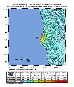
2010 Eureka earthquake
The 2010 Eureka earthquake occurred on January 9 at 4:27:38 pm PST offshore of Humboldt County, California, United States. The magnitude was measured 6.5 on the Mwscale, and its epicenter was located offshore in the Pacific Ocean 33 miles (53 km) west of the nearest major city, Eureka.[1][6][7][8]Additionally, there was a separate earthquake further offshore of Eureka on February 4 with a slightly lower magnitude of 5.9.[9] It was also the most significant earthquake in the Eureka area in terms of magnitude since the 1992 Cape Mendocino earthquakes.[10] It was felt from Santa Cruz County, California in the south, to Eugene, Oregon in the north and to the east as far as Reno, Nevada.[7]


No comments:
Post a Comment
Note: Only a member of this blog may post a comment.